Project Details

We are developing and supporting the app with 35 million downloads!
You can find and test it in Google Play Market: Maps Navigation & Routenplaner.
The app provides enhanced services for maps navigation and POI finding.
Users can select different types of routes: public transport, car, and etc.
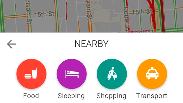
To find the nearest bus station, restaurant or museum user just clicks an appropriate POI type. After that POI items will be shown on the map. Notice that the list of the frequently used POIs will be updated each time according to the user’s selection.
Users can share their position, check their walking speed.
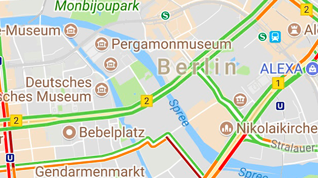
The app supports 6 map types: Standard map, Traffic, Cycling, Satellite, Transport, Walking.
Users can choose the Language that they prefer. We created the app localization to major languages.
The advanced features include Wikipedia, Youtube, photo and weather integration. The coding is with Googlemaps API and OpenStreetMap (OSM).
In the version that we are developing we are adding one more attractive feature - Local Events! If you has a free time , but do not know what to do, just click Event button! Events near your will be shown on the map with detailed description, start/end dates and etc.
- rewritten the system from KendoUI mobile + JQuery to AngularJS framework, Angular Material;
- updated the app look according to the Google material design guidelines;
- app built into APK by Apache Cordova.